Article in Issue 1 of Volume 30
The International Hydrographic Review (IHR) has recently published a selection of papers from HYDRO, the annual hydrographic conference of the International Federation of Hydrographic Societies (IFHS). This year's conference was a hub of innovation and collaboration, showcasing advancements in ocean mapping and hydrographic research.
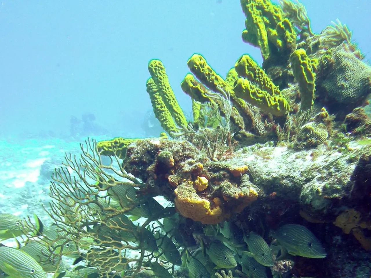
One of the standout initiatives highlighted at the conference is the IHO Crowdsourced Bathymetry (CSB) initiative. This platform gathers hydrographic data from a diverse range of contributors, aiming to accelerate the mapping of the world's ocean floor. The collected data is compiled into the GEBCO Ocean Map, a global bathymetric dataset freely available to scientists and stakeholders.
The CSB initiative plays a pivotal role in various fields. For instance, it supports ocean exploration by providing detailed maps of previously unmapped or poorly mapped sea floors, crucial for navigational safety and the discovery of underwater features. In oceanography, it supplies bathymetric data that help understand the seafloor topography's influence on ocean currents, circulation, and marine ecosystems. For marine geology, it offers geological context and baseline data about underwater formations and seafloor characteristics, guiding research in sedimentology, tectonics, and resource assessment.
Moreover, hydrographic data, such as those collected by the CSB initiative, are essential for a wide range of purposes, including assessing the impact of climate change on ocean circulation, mapping mussel habitats, predicting coastal erosion, and identifying suitable areas for offshore renewable energy infrastructure.
The IHR's 30th volume also features articles on the Baltic Sea e-Nav project, a partnership for the future of marine navigation, and a keynote article on the exploration of deep-sea biodiversity. Matthew Woodlief's conference paper discusses unlocking insights from hydrographic data with GeoAI, while Matthias Hinz et al. present a workflow for fully automated AI-based boulder detection in sonar data.
The conference also addressed the quality and legal concerns surrounding CSB data, as well as the potential for adding Discrete Global Grid Systems (DGGS) support to the S-100 Universal Hydrographic Data Model. Tanja Dufek et al. used deep-towed multibeam echosounder data to locate active hydrothermal vents, while Jennifer Jencks & Belen Jimenez Baron presented CSB as part of the modern hydrographic toolbox.
The IHO Data Center for Digital Bathymetry (DCDB), hosted by the U.S. National Oceanographic and Atmospheric Administration (NOAA) on behalf of the IHO Member States, archives and shares ocean depth soundings collected since 1990 by various vessels. Over 1 billion crowdsourced depth data points have been collected and stored in the DCDB.
The conference concluded with valuable information on empowering hydrographic professionals, a review of the book "The deepest map - The high-stakes race to chart the world's oceans", and a presentation of the International Federation of Surveyors' forthcoming four-year work plan for Commission 4 - Hydrography.
In summary, the IHR's publication of papers from HYDRO 2023 showcases the significant strides being made in ocean mapping and hydrographic research. The IHO CSB initiative, in particular, serves as a collaborative platform to gather hydrographic data from various participants, enhancing baseline datasets critical for ocean exploration, scientific oceanography, and marine geology research. This shared effort helps address knowledge gaps and supports the overarching objective of complete and accessible ocean floor mapping.
- The IHO Crowdsourced Bathymetry (CSB) initiative, a highlight from the conference, gathers environmental-science data for the advancement of scientific oceanography and marine geology.
- The collected hydrographic data, such as those from the CSB initiative, are vital for climate-change research, helping to assess its impact on ocean circulation.
- Technology, specifically data-and-cloud-computing and GeoAI, is being leveraged to unlock insights from hydrographic data, as shown in Matthew Woodlief's conference paper.
- Lifelong-learning and educational opportunities were also emphasized at the conference, with presentations focusing on empowering hydrographic professionals and advancing hydrography through initiatives like the International Federation of Surveyors' Commission 4 work plan.